Laser scanning or lidar technology is used in many fields. Maybe it is because of this wide range of applications there are scant comprehensive resources on the subject. Even within a single field of application, such as terrestrial or aerial laser scanning, it is hard to make comparisons between the technological solutions and their capabilities.
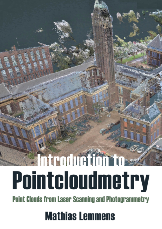
 Taking a different approach, the recently published book Introduction to Pointcloudmetry (Whittles Publishing) from Mathias Lemmens describes point cloud technology and its place within the wider geomatics field. This means that interested readers will learn what exactly do sensors measure, how they do this, for which purpose and how these measurements are transformed into accurate 3D mapping data.
Complementing disciplines
While the term “pointcloudmetry” may sound odd and idiosyncratic, it logically follows from the fact that both photogrammetry and laser scanning can complement each other in practice, hence the author’s decision to focus on how both technologies are related. The term, coined by the author himself, encompasses the technologies for obtaining accurate and detailed information about earth-related objects, including the bare earth surface, by acquiring and processing point clouds.
In the preface of the book, the author writes that the rapidly growing importance of point clouds is not yet reflected in a substantial number of textbooks. Also, existing books on the topic stem from conference papers written in an academic tongue directed towards peer experts, which affects coherency in terminology and elucidation of concepts. The book is an attempt to solve these problems and provide a single source on point clouds for an audience of geography and geomatics students, GIS analysts, geo-scientists and practitioners using geodata in their daily work. Readers are assumed to have basic knowledge of mathematics and statistics, as the text includes many examples that use both.
Book contents
The book starts with an introductory chapter, after which the basics of electromagnetic energy and laser, a particular type of electromagnetic energy used for generating point clouds. This acquisition process (both airborne and terrestrial laser scanning) are covered in the second part of the book, after an introduction on photogrammetry and 3D computer vision theory.
The book includes no less than three chapters on digital terrain representations. The author justifies his choice because “of its huge importance for environmental analysis, governmental planning and monitoring, construction engineering and support the quest of gaining insight into the physical processes that the earth endures”.
The book’s final three chapters cover 3D mapping of point clouds. The main point is a chapter on feature detection from images and point clouds, followed by a brief chapter on the functionalities of point cloud processing software. The final chapter gives an overview of “pointcloudmetry” pilot studies and applications. All project descriptions are from 2009 onwards. These include corridor mapping, cultural heritage, mining, 3D mapping and forestry. Although the overview of individual projects is very informative, it is incomplete and leaves out important areas where laser scanning technology is pushed to limits: notably absent here are lidar applications for automotive and how for example manufacturing companies use indoor point clouds for the production of digital twins.
The book is clearly written as a student reference book, as each chapter contains a number of concluding remarks that rephrase core concepts and conclusions, followed by a reference list. The book comes with a list of abbreviations, and three separate indexes of applications, formulas and keywords. There are more than 200 color illustrations, graphs and other elucidating portrayals clarifying concepts and formulas.


