

Contributed by NavVis
Today, licensed surveyors are starting to put mobile mapping through its paces in projects like topo survey, building survey, bridge capture, and more. In the process, they’re determining whether this technology really belongs in a surveyor’s toolbox.
Recently, NavVis caught up with two such surveyors to discuss their real-world experiences. Over the course of an hour-long webinar, Ben Shinabery of Qk4 and Jeff Voorheis of Voorheis & Voorheis shared their perspectives on the pros and cons of using mobile mapping in survey projects.
They talked accuracy and speed (of course). But they also dug into the mobile-mapping benefits they wouldn’t have known about before taking the plunge.
Here are some highlights from that conversation: Three hidden strengths of mobile mapping for professional survey.
(If you’d like to jump straight into the webinar, you can find the recording here.)
It levels up your on-site photography
A surveyor once told me that whenever you need a photo of something after you’re back in the office — that’s the one thing that someone forgot to photograph.
According to Shinabery and Voorheis, mobile mapping systems can make this problem a thing of the past.
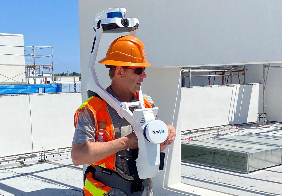
As Voorheis notes, the mobile mapping workflow involves “moving the scanner throughout the scene.” You carry it around corners and walk around obstructions to ensure that the device captures 3D measurement points for the whole site.
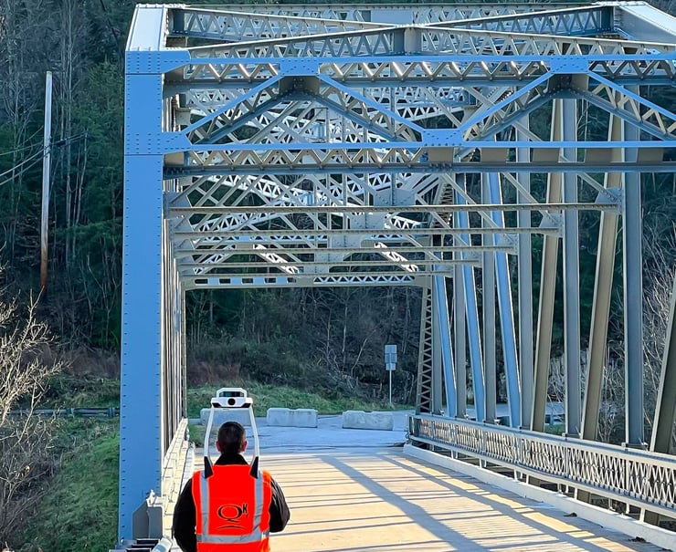
Source: Jeff Voorheis
Shinabery says this workflow makes mobile mapping devices ideal for photographic capture. Since tools like NavVis VLX include HD cameras in their sensor payload, they capture RGB (or photographic) data continuously — without any extra effort from you.
On top of that, the optics and processing are configured to capture good photos automatically, in varying lighting conditions. Shinabery says this makes the color balancing better than other RGB capture methods.
Mobile mapping saves you time with color capture while ensuring you get the whole scene. No more getting back to the office to find that you forgot to capture that one feature you needed.
Stress-free capture of critical features
Shinabery says that mobile mapping systems enable his team to gather a significant amount of 3D context on site. What’s more, by aligning and integrating the point cloud and locking it down to the survey, they can use the same mobile mapping data for surveying critical features.
“We find that bridge environments are great for this,” he says, “because it's difficult for a field crew to know the exact point of the critical feature. Peer cap elevations, abutment wall elevations, the beams that come through any of the cross beams, horizontal location of peers, elevation, clearances, utilities, etc. All of that is collected within the scans.”
 Source: Ben Shinabery, Linkedin
That means the field crews don't even have to think about manually collecting critical points. That saves them time and effort and reduces the possibility of human error.
“We can focus on the bigger picture,” Shinabery says, “and then use validation points to validate the point cloud on the back end. That workflow has really been an asset to us.”
New value-add services
During the webinar, Voorheis explained that his mobile mapping has helped him grow his business in unexpected ways.
He detailed a project for a customer that wanted the site of an apartment complex surveyed. His team performed their usual survey and scanning workflow. That included capturing the inside of the building with NavVis VLX.
“What I love about this data,” he says, “is the color and detail.” He notes that the data was good enough that his team simply “sliced the point clouds a few feet off the ground. From there, we drafted a traditional AutoCAD file, and handed the client a full floor plan.”
Mobile mapping has enabled Voorheis and his team to offer a service that wouldn’t have been cost-effective before.
“We don't get a lot of requests to do floor plans,” he adds. That’s “because a staff architect can go out with a clipboard and measuring tape,” which is more enticing to the client than paying the “high price” of a survey crew.
Now, Voorheis says, mobile mapping has made it simple to throw in the floor plan as a value-add. “It's almost like the fries that come with the hamburger meal. I've been able to upsell several jobs saying ‘Hey, would you like a floor plan with that survey? Because I'm going to have to walk through your place anyways.’”
Wrapping up
While it may seem mobile mapping is only good for increasing the speed of 3D capture, Shinabery and Voorheis showed that the tool can offer a lot more to the professional surveyor.
Throughout this hour-long webinar, they also shared the surveyor’s perspective on a variety of topics related to mobile mapping. That includes:
- the true accuracy of mobile mapping
- how colorized 3D data can help you communicate with non-surveyors
- how mobile mapping data compares to — and sometimes improves on — traditional survey data
- which survey projects are right for mobile mapping
- the future of mobile mapping in survey
- how to achieve the best accuracy
...and much more! Click through to the full webinar here.
About the author: Sean Higgins is an independent technology writer, former trade publication editor, and outdoors enthusiast. He believes that clear, buzzword-free writing about 3D technologies is a public service.


