What is ArcGIS IPS?
Location intelligence provider Esri announced the release of its own indoor positioning system, ArcGIS IPS. With it, users can locate their current position inside a building on a map, just as they would using GPS in an outdoor environment.
The new IPS combines beacon technology, mobile and desktop software, so that mobile users have an Esri mapping environment available on their mobile devices, that provides real-time positioning which can be the starting point for numerous new applications, such as routing and wayfinding. From an analyst point of view, data can be aggregated and analyzed to discover spatial patters using Esri’s own software products. Esri UK recently put the system to the test at the University of Oxford.

How does it work?
ArcGIS IPS indoor positioning capabilities are made possible through Bluetooth Low Energy (BLE) Beacons that need to be placed inside a venue, and whose signals are picked up by a mobile map named ArcGIS Setup. ArcGIS IPS is available for users of Esri’s Indoor Mapping Solution called ArcGIS Indoors, and ArcGIS Runtime SDKs, which enables the indoor positioning capability in custom-built apps.
Apart from the mobile app, ArcGIS IPS comes with a set of geoprocessing tools to set up and author the user’s IPS environment in ArcGIS Pro, Esri’s desktop mapping software product. This means that such an indoor mapping environment needs to be created first through Esri’s ArcGIS Indoors solution, before it can be used. This would include digitizing of floorplans and integrate them in connected mapping environment that relates to the individual floorplans. ArcGIS Indoors enables the creation of routing plans, that can be now communicated to mobile users inside a venue now that finally indoor positioning capabilities are added to Esri’s product portfolio.
Mobile and indoor GIS use cases
The announcement of the new release mentions a number of use cases that have now become a reality with Esri offering indoor positioning, such as:
Real-time localization and positioning, which enables orientation for mobile users in new or complex environments.
 Real-time navigation and wayfinding: in combination with Esri’s ArcGIS Indoors, real-time routing and navigation inside a venue is now possible. The mobile app used is required to support routable networks for this.
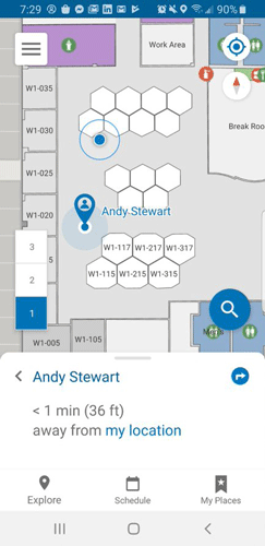
Live location sharing & tracking: this helps others find you quickly inside a venue. Uses need to opt in to share their location as it is not a default setting. Location tracking can be handy for facility and security managers.
Location data capture: this feature is meant for maintenance and repair work, using the real-time positioning capability for marking the exact location when there’s an issue that needs to be fixed.
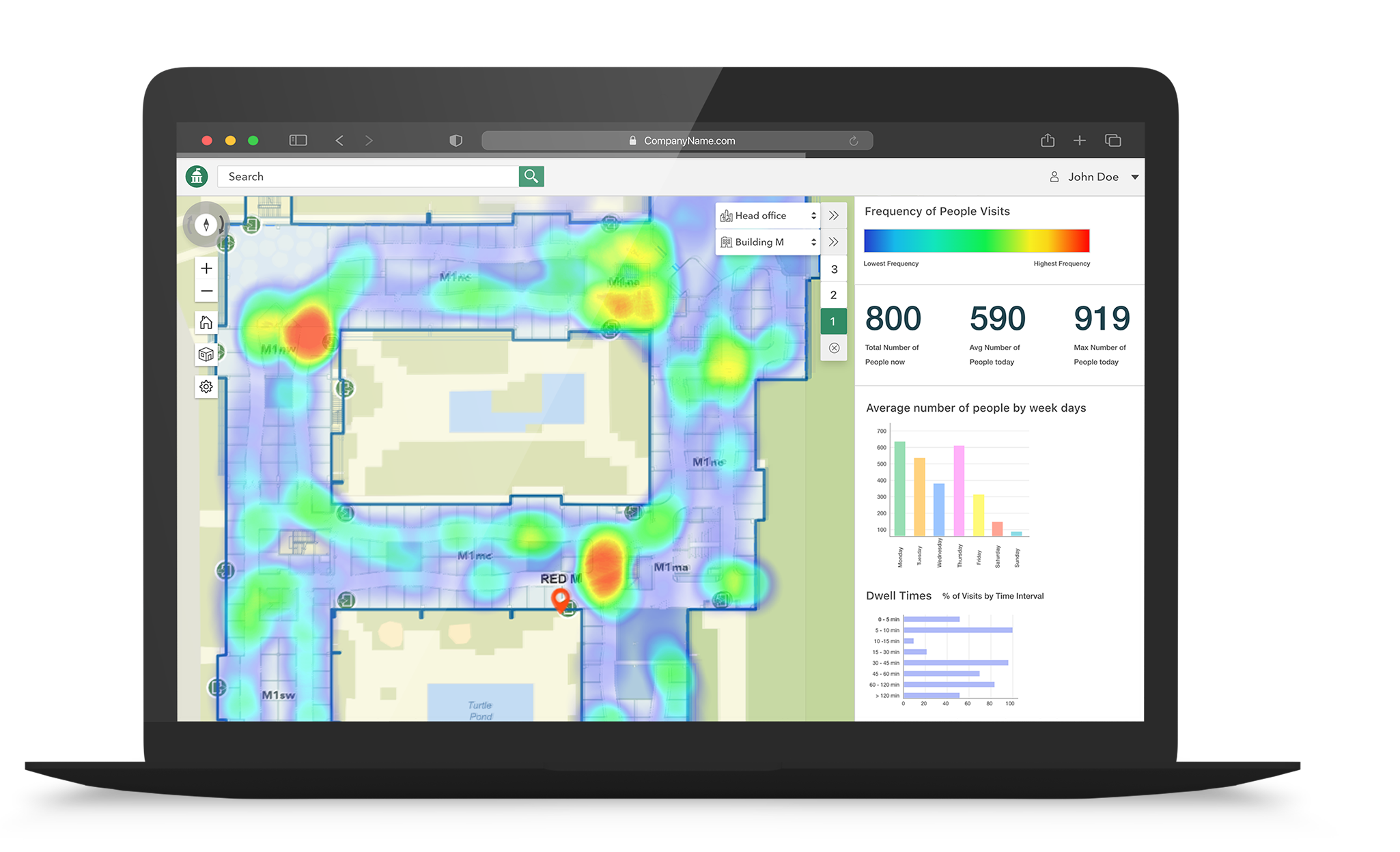
Analytical insights: by capturing anonymous location data such as foot traffic, it becomes possible to visualize and analyze it using GIS solutions and take informed decisions based on the data.